
Totu N. Gabriel
Solutions
If we drink half the glass of science we can have doubts about the existence of God, if we drink the whole glass of science then we cannot deny the existence of God
Albert Einstein
This is sum of many questions for which I have found answers based on scientific explanations from : physics, chemistry, botanical, ornithology, entomology, these science are connected for the obtaining of the drinking water and water for irrigation to provide the bare human needs : clean air, water, food.
1. Why I publish my work on internet ?
After many years of certain studies , observations , experiences , work in agriculture mechanization , forestry , beekeeping I have developed certain , unknown , innovative solutions to increase the water flow of creeks , rivers , lakes .
Nature makes us alike, education makes us different
Confucius
I have decided to publish all my questions , answers , solutions hoping that some people will appreciate right the feasibility of my solutions to stop a humanitarian disaster caused by the water scarcity results : thirst , hunger , diseases like cholera which infected , killed already people in Malawi , Syria , Lebanon , etc.
2. ,,Where does a spring
get its water ?”
This question I have found on internet and I will try to answer at this question.
After several years of drought, of which the last two years were totally devoid of precipitation , I have found springs with water flow at the top of a forested hill.
I was curious searching information in books, magazines, internet to know by where is the water of these springs, the answer which I have found was that the water of springs is from accumulated precipitations in certain underground layers ; of limestone, rocks , sand for example, after the permeation through soil after long time .
- If would be so , the soil would reach muddy and muddy water would reach in the infrastructure of springs and the springs water would be muddy, I have never seen springs with muddy water.
- If the water would be accumulated will have a certain pressure which would erode the rocks , forming underground network of tunnels through which the water would flow out fast, the remaining in layers would not be possible.
- After so many years of drought the soil in my backyard is completely dry in the summer, autumn time, after a short rainfall 3,7 cm of water was collected in a bucket , at the same deep in soil the water was infiltrated remaining above , at the surface of land , because the soil has a certain capillarity, working like a sponge , always the dry soil it is filling with water from above , so if the water should reach to the springs infrastructure , or water table which is many time below one meter in the ground, then is necessary a rainfall of more than 1 meter which is like the flood of Pakistan , Libya , without considering that a part of the rainfall flow down on slops , creeks, rivers .
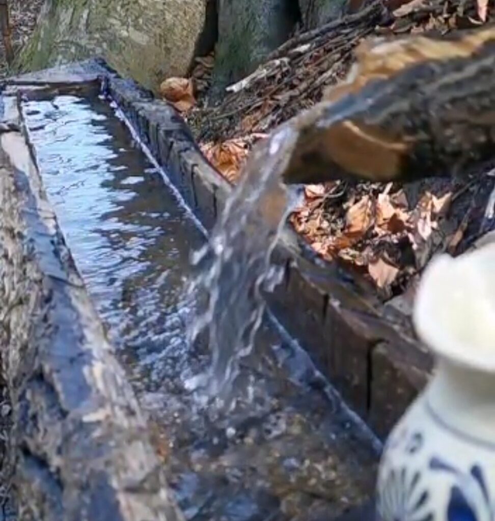
- If the water of springs would be from accumulated water from rainfalls, then the water flow of the spring should be the same or each day a bit lower , after following the water flow of few springs water which I have collected I noticed that sometimes the water flow is not constantly , is coming sometimes in waves in April, May, and on Monday , 10 July after a warm night with 16 C° the drain chute of the spring was full with water. The more warm is the air, the more water result from condensation when the air touch the cold soil, rocks, sand, limestone.
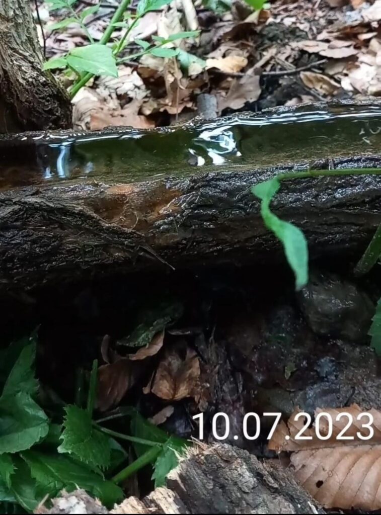
5. In the night before Tuesday 18 July after another warmer night with 21 C° I was waiting to be more water flow on the drain chute of the spring , I was surprised unpleasantly to notice that the water flow was lower, why , after a few minutes of wondering I have felt the wind blowing in my face. The wind makes the temperature of the slopes the same, the result is warmer northern, wastern slope = lower underground air speed = less condensation, spring water flow if the southern slope ( where the warm air enter in underground ) has the same temperature like the northern slope where is the spring which water flow I follow.
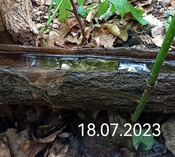
6. During the summer time the water flow was of 5 liters of water in 63 seconds , on Tuesday 7 November the water flow was of 5 liters in 170 seconds because the weather was reaching colder , on Wednesday 29 November the water flow was more lower of 5 liters in 250 seconds , the atmosphere temperature reaching much below 0 C° .
7. Close to this spring at 50 meters another spring water with other spring infrastructure was collected by my grandfather brother 70 years ago , never dried even if was droughts ; in the summer time the water flow was of 5 liters in 47 seconds , in 29 November has increased at 5 liters in 36 seconds having a longer spring infrastructure, underground creek more warmed by the heat of the sun after the leaves fall from trees. The more long and warmed is the infrastructure of spring ( underground creek ) the more water flow is.
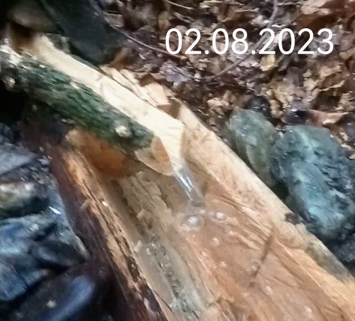
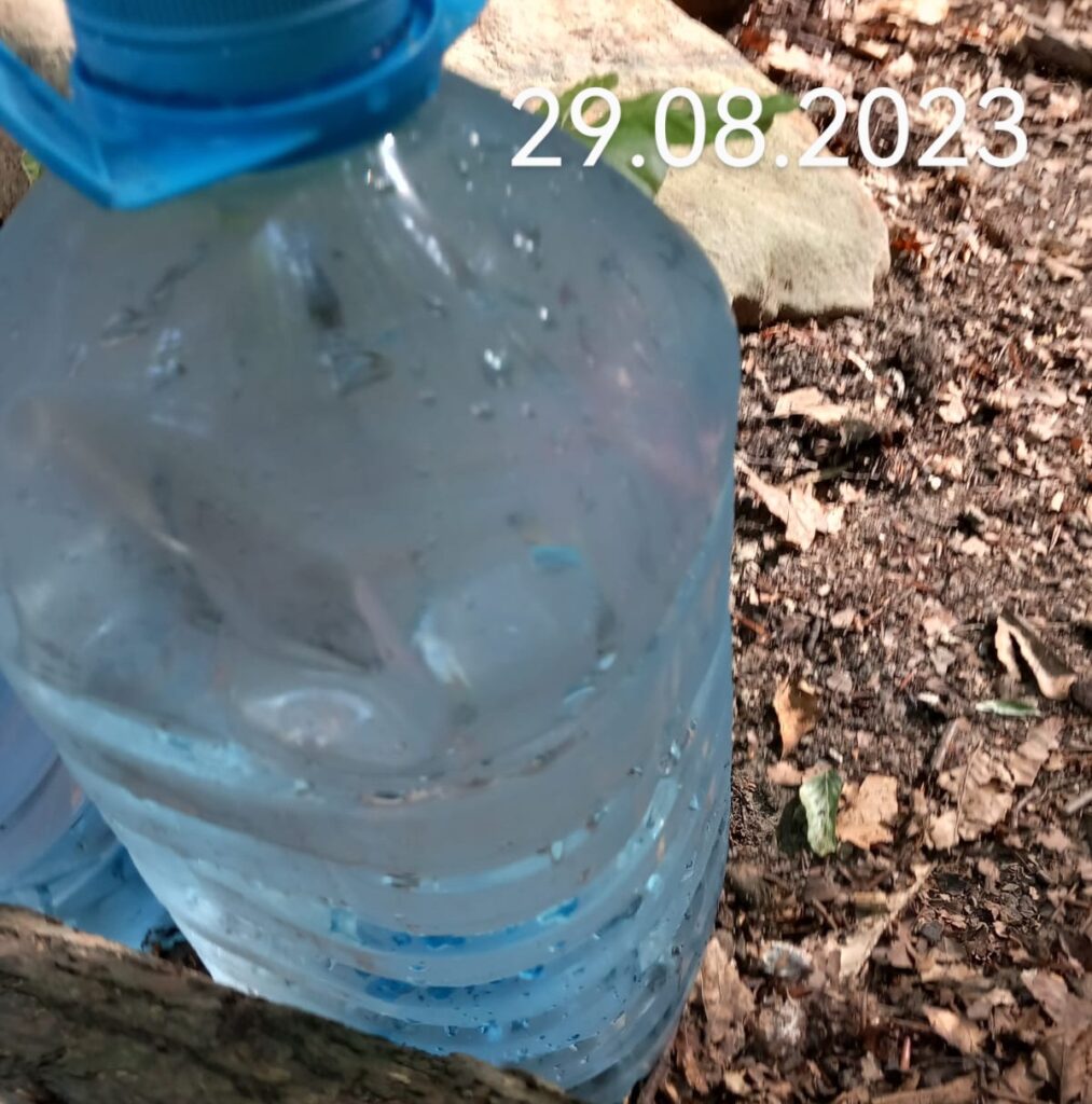
8. I have noticed too that on Tuesday 29 August the bottles filled with water make condensation on the outside. When the air is much more warm than the spring water, the water flow of spring is more.
Conclusion
- Considering that since long time almost 2 years was no precipitations , rainfalls , snow falls;
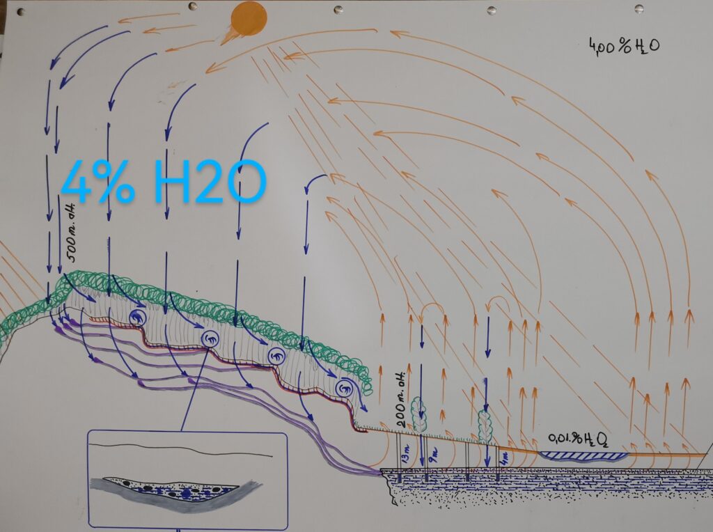
- Considering that the water flow of springs is more influenced by the weather conditions : atmosphere temperature , currents of air ( wind , downdrafts of air from the higher altitude of atmosphere where are 4% vaporized water in comparison with under 1% vaporized water in atmosphere at the level of soil;
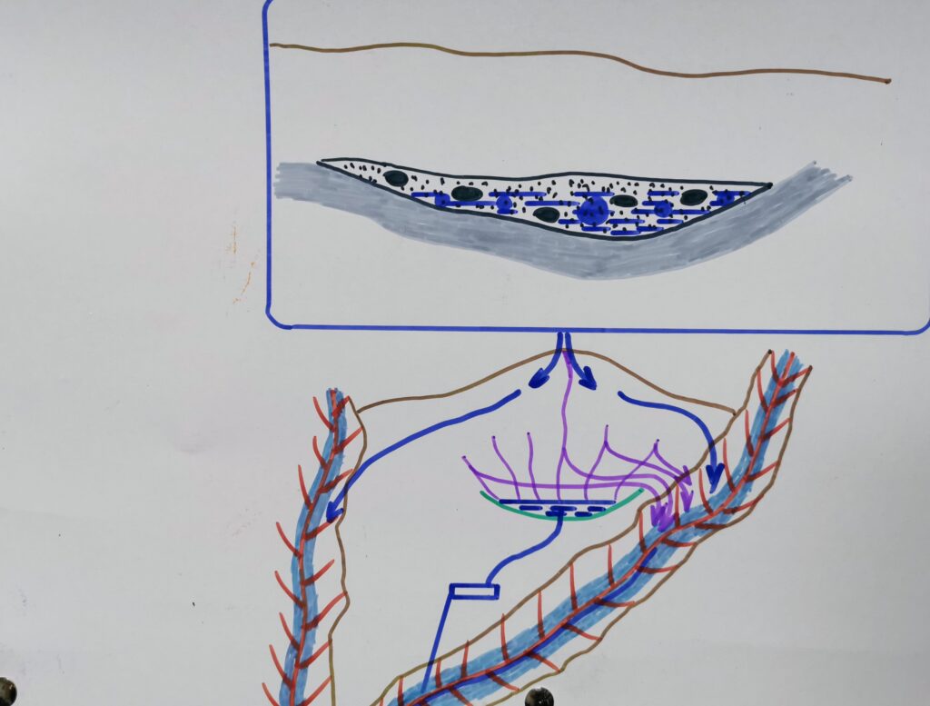
- Considering the drawing of below in which I want to show that is visible the air and water circulation in atmosphere and soil, rocks, springs infrastructure, water table in the valley of Bistrita;
- I consider that the springs water, water from the groundwater table is the result of underground condensation when the warm air reach the cold soil, rocks, sand, limestone layer, the air with humidity having a higher temperature with average 10 C° than the soil, rocks, limestone layer, which temperature is in average of 5 C°, the same condensation is happening when the air of a room is warmer with 10 C° than the temperature of walls, windows.
5. Some people, scientists suppose that the spring water, water from the groundwater table is from precipitations : rainfalls, snow falls
6. Why ? Because we see when the water of precipitations flow in soil, but we do not see the air coming out of the ground or entering the ground.
7. After many observations, I noticed many similarity of the terrain where springs appear, in certain slops in shade, cold places where the soil surface is cold the cold air from rocks, sand , limestone, soil flow out of soil because has a lower temperature ( 5 C° ) and is heavier, the place of this cold air which flow out is taken by the warm air which has a higher temperature, reaching the cold soil, rocks, sand, limestone layers, make condensation ; in the same time resulting a decrease in volume of the air and a effect of pumping which will not pull back the colder air and the condensed water of below which usually is in the northern, western slop, but instead will pull inside of hill, mountain warmer air with 4% water as gas which is at higher altitude of hills, mountains of the southern, eastern slops more warmer by sun.
Such places occurs where a crest of a hill situated between two ravines and in the place where the ravines comes together which after is a big slop in the ravine new formed, usually at the edge of a platform in slope, on the northern, western slops in the northern hemisphere, on the southern, western slops in the southern hemisphere.
8. Such cold places occurs too in the places where are pure forests of picea abies which provide cold shade during all the year time in the southern, eastern slops in the northern hemisphere, I have not found similarity for the southern hemisphere
9. I noticed after many years that 2 puddles, little lakes has dry after a forest of picea abies was cut down and in the place was planted acer platanoides , not far from this forests is another puddle which has close a forest of picea abies which still has water, less than before the cutting of a part of the picea abies .
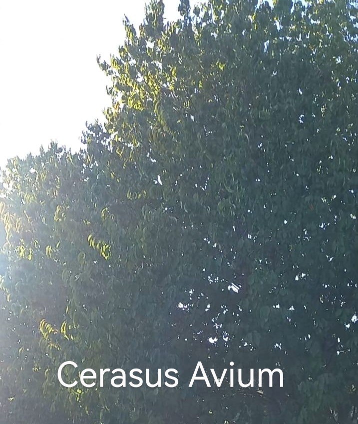
10. I noticed too that a spring which was on a northern slop, close to a crest, and a southern slop had more water flow 40 years ago when the forest of fagus silvatica was cut down, growing again the forest of fagus silvatica , tillia tomentosa , cerasus avium, the second is considered a invasive species, but I consider that offer more dark shade, if we look at the branches with leaves we do not see the sky, considering the photos below, these two species having more dark shades offer lower temperature for the atmosphere and soil of below making downward currents of air which in northern slops favors the increase of the water flow in springs infrastructure, underground creeks which supply with water the groundwater table. In the southern slops because keep cold the soil surface and atmosphere below of the branches with leaves decrease the water flow of springs infrastructure and creeks which supply the groundwater table with water. The more cold are the northern, western slops, the more warm is the southern, eastern slop; the more water flow will have the springs situated usually on the northern, western slops.

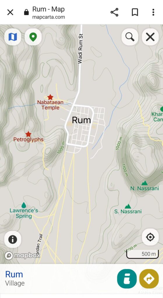
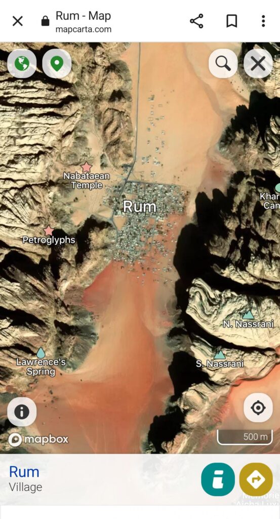
11. As proof in the desert of Rum, The Hashemite Kingdom Of Jordan, in a shady ravine ,, Great Siq ” are the springs of a creek, the springs of Wadi Rum are too in the shade of Nassrani mountains, peaks; Lawrence s Spring is close too of a hill shade, considering the following photos:
12. Another proof is at north of Jabal Mizan, at north of Rum.
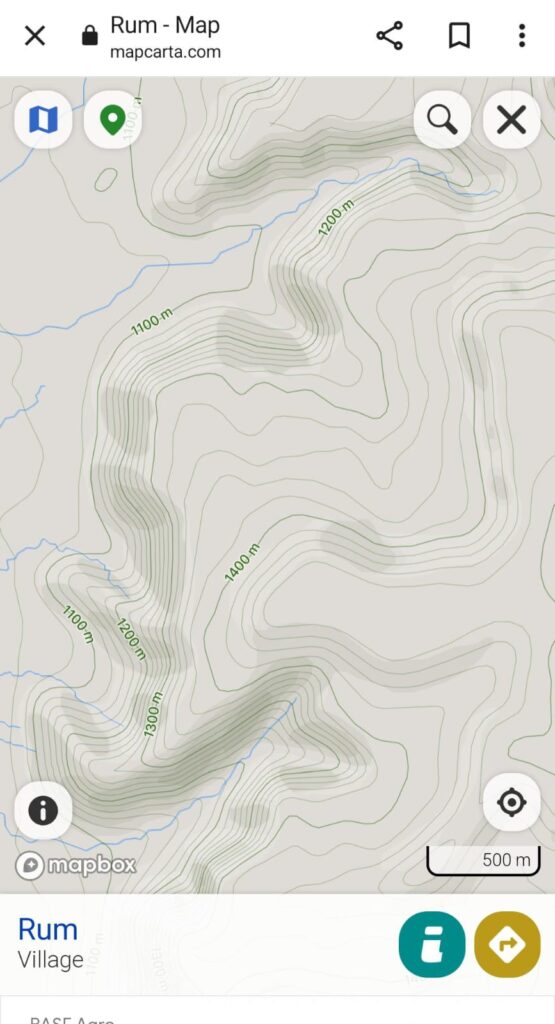
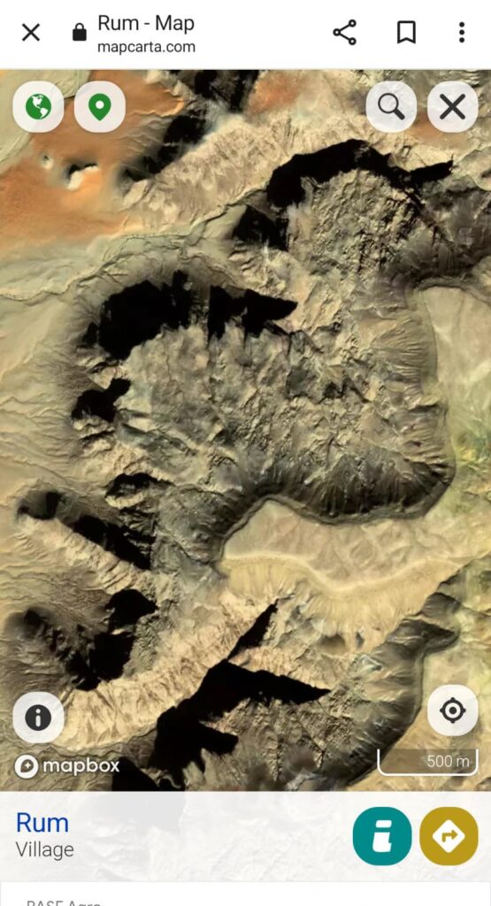
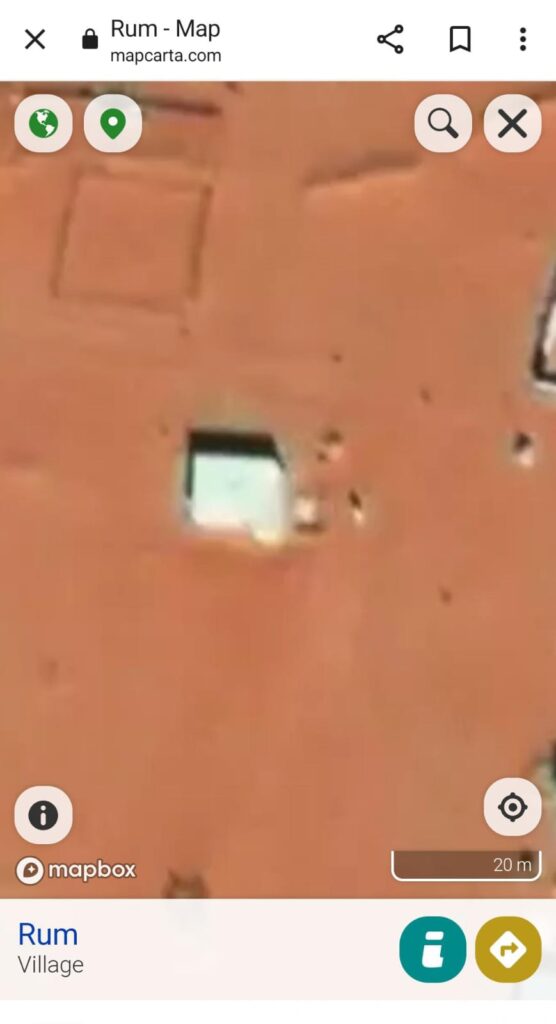
13. These proofs are possible considering that the photos were made at 10 a.m. local hour which I have found analyzing the shade of a house ( the next photo )
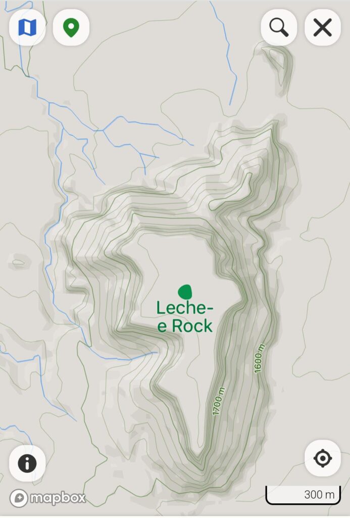
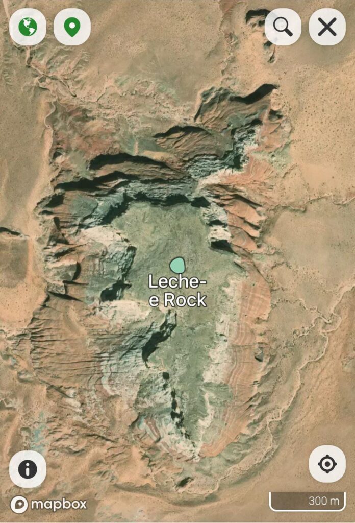
14. The next proof to prove my affirmations is from a hill, mountain: Leche E Rock situated on Navajo Territory in Arizona State of USA, where is visible that springs, creeks occur on the shady northern, western slops and not on the southern or eastern slops.
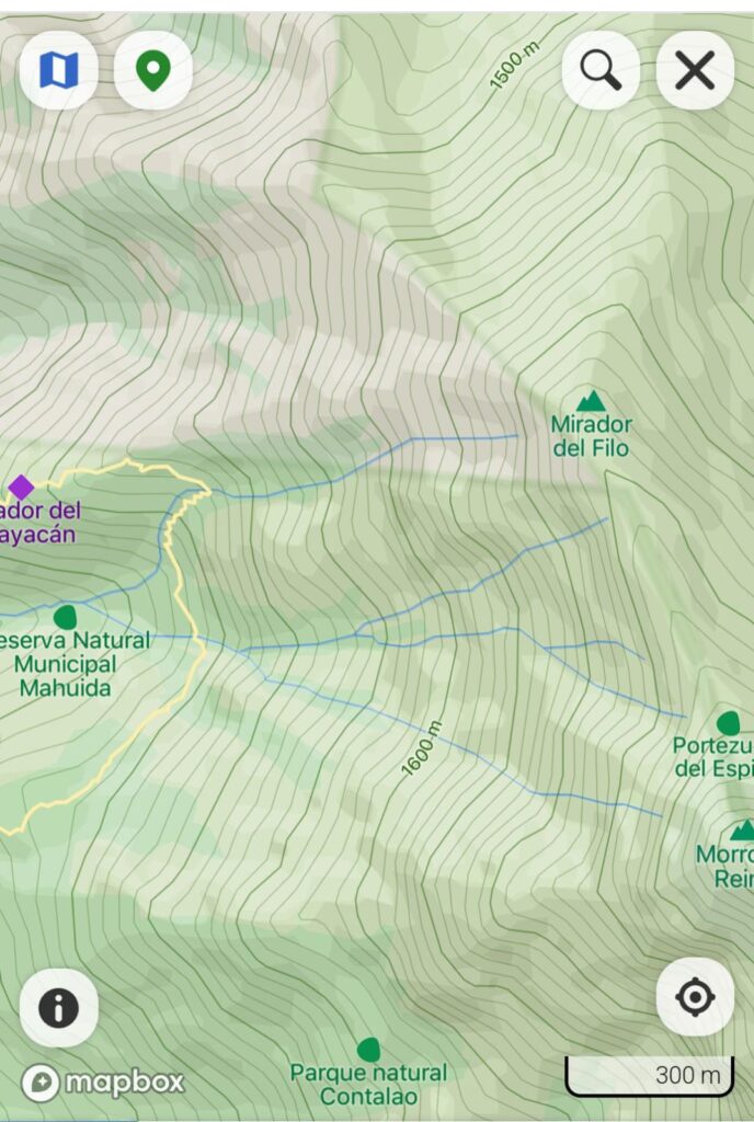
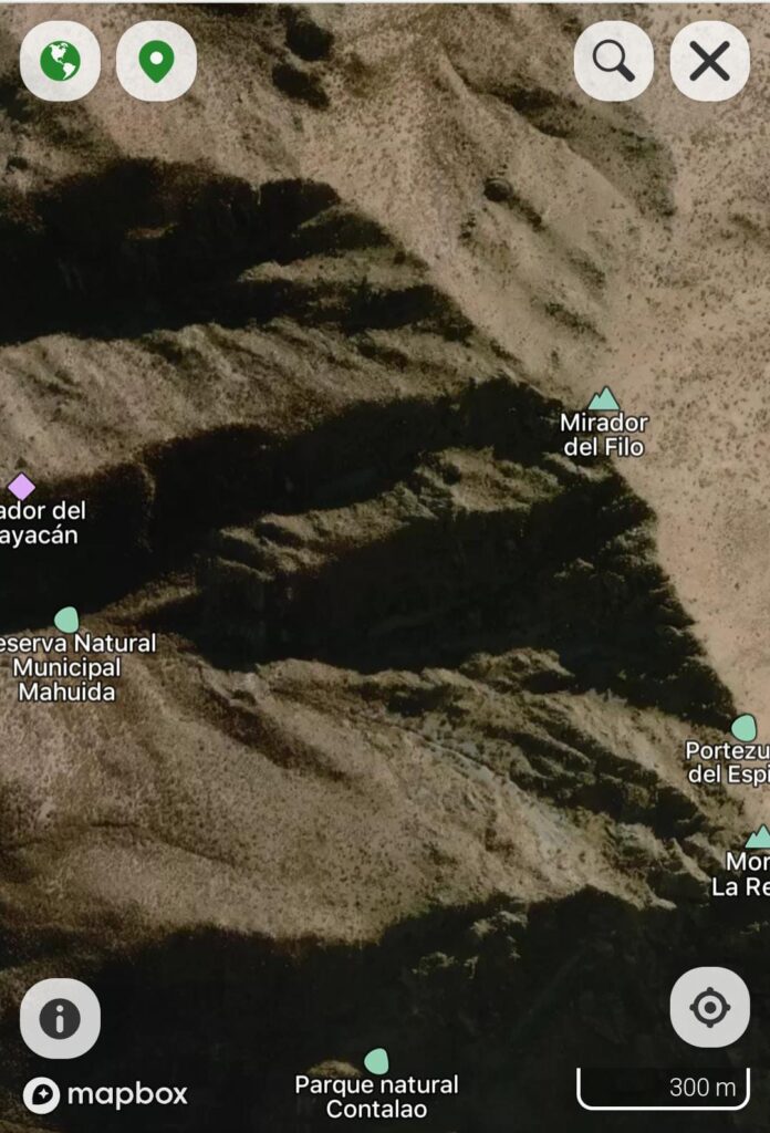
15. In the southern hemisphere springs, creeks appear on the southern, western slops, as proof photos from the eastern side of Santiago de Chile
3. Where springs occur ?
- I have found published information that springs occur where a river cut a water table; very true, but not only, when I have collected the water of the first spring which water flow I follow I have noticed digging that the water of the spring result from a underground creek formed by a layer of sand, little rocks like are at the bottom of the river, with eroded edges, below this layer was a layer of a blue clay which maintain the water above in the layer of sand, little rocks.
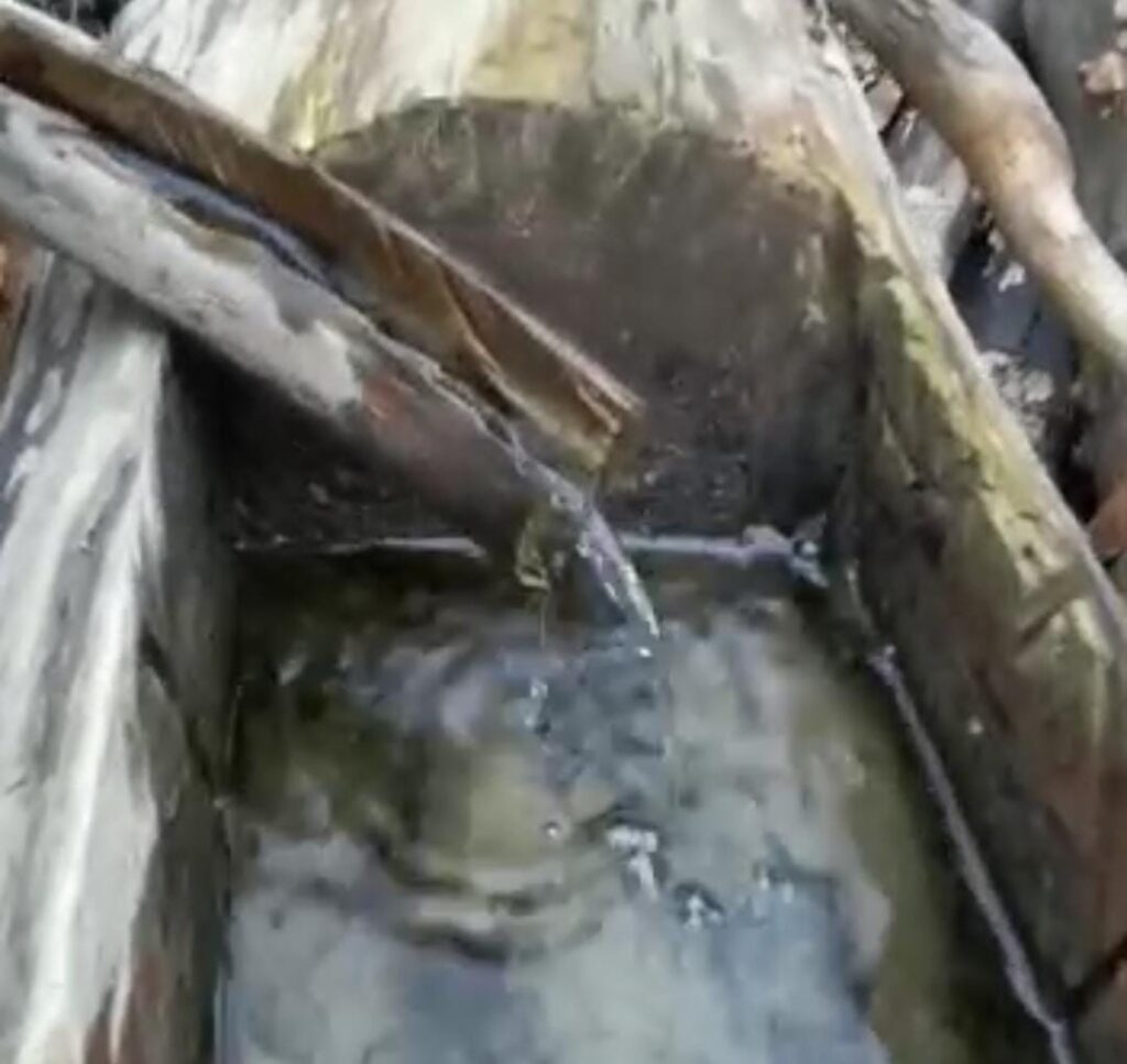
Such underground creeks, springs infrastructure are forming after the condensed water wash out the mud of underground and remain the rocks, sand which below is forming a layer of blue clay which is the result of long contact of soil, sediments with water, making the soil to have a higher density through which water does not pass. I consider this happening to result blue clay because after a forest of picea abies was cut down a small lake ( which was deep of 2 meters ) has dry and the bottom reach above until almost the shore level
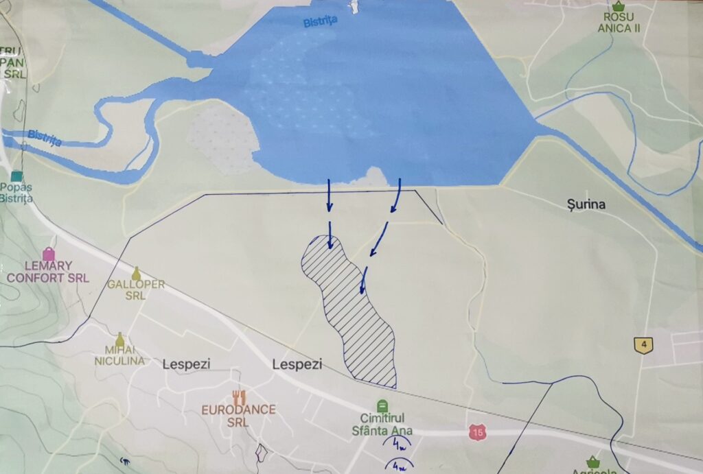
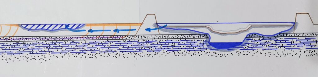
To support my affirmation, observation 60 years ago a lake was build on the Bistrita River nearby my home using dams ; without the existence of this blue clay on the bottom of the new formed lake the water flooded underground passing a valley which is at the same level forming a small lake; after the forming of the blue clay this small lake of valley has dry and again the bottom reach almost at the shore level.
2. I never have found ,, aquifers ,, following the underground creek using two aluminium electrodes in my hands, I have noticed that this underground creek follow the crest of the hill in slope which is between two ravines on the direction north-south until the crest which was between the northern slope with the spring, underground creek and the southern slope more warmed by the heat of the sun.
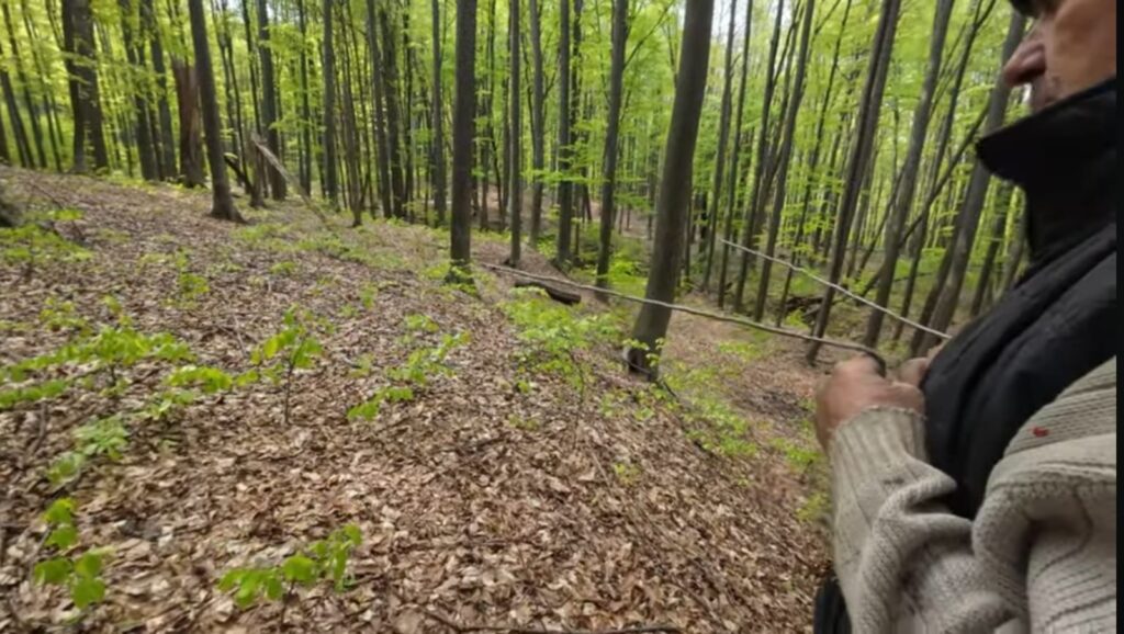
3. The same blue clay was formed from soil after rainfalls under the puddles formed on field, on roads, on the bottom of creeks, lakes.
4. My grandfather told me once that because of this layer of blue clay many times the terrain from above slide down, and this is happening usually on the northern slops after the forming of such many underground creeks which water after sometime transform the usual soil in blue clay.
5. Why the underground creek flow under the crest of between two ravines ? Because at the bottom of the ravines which is cold the air cooled by the soil, rocks, sand, limestone, flow out and the place is taken by the warmer air which flow in the underground infrastructure of the underground creek, reaching the cold infrastructure makes condensation.
6. I have noticed that the underground creeks which infrastructure is made by sand, limestone layer has lower water flow because the air which pass through the creek infrastructure is less, so lower speed, lower condensation, lower water flow.
7. I have noticed too that the underground creeks which infrastructure is based on bigger rocks, stones between which the sand, the limestone was washed out has more water flow because more air with higher speed circulate between rocks, making tunnels, caves, karst infrastructure.
8. As proof at the exit of the water from a such spring I have found a limestone deposit showed in the photo of below :
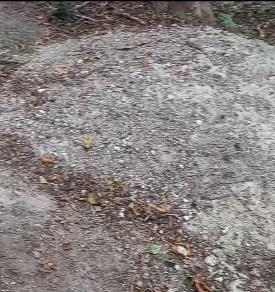
4. By where is the water of groundwater tables ?
- From the information which I have found published the water of groundwater tables is from the rainfalls water, snowfalls water after it passes through the soil and reaches the groundwater table.
- This is happening during the floods when because of the water which flood the field manage to reach in the groundwater table without having a layer of blue clay to stop the reaching of the water in the groundwater table.
- If the water of groundwater table would pass through soil then the water of groundwater table would be contaminated with the very many kind of bacteria which would cause diseases, pandemics caused by : Yersinia Pestis , Burkholderia Pseudomallei, Bacillus Antracis, Clostridium Tetani, Clostridium Botulinum, Listeria Monocyctogenes, Francisela Tulaurensis, Mycobacterium Lepre, Schigella spp, Salmonella Enterica, Campilobacter spp, Escherichia Coli ( espho157:h7 ), Legionella spp, Coccidioides spp, Blastomiyces Dermatitidis, Histoplasma Capsulatum, Sporothrix Schenckii,Exserohilum Rostratum and many unknown emerging viruses
- I have found too from published information that the same water of groundwater table could be from the water of creeks, rivers, lakes.
- This is not possible because in time on the bottom of such water courses under the action, contact of the water with soil, sediments the same blue clay stop the water to reach below in the groundwater table.
- If the water of creeks, rivers, lakes would reach in the groundwater table then would reach too certain bacteria which causes diseases : Vibrio Cholerae, Cryptosporidium, E.coli, Schigela, Pseudomonas, Naegleria Fowleri
- During the floods through fountains accidentally could reach such bacteria ; Vibrio Cholerae is developing on the phytoplankton, zooplankton which grew, developing in the presence of the light; which is not possible in the groundwater table water without light.
- Assisting at the digging of many fountains I have noticed that under a layer of a soil is a layer of a mixture of rocks, sand which after below at 1-2 meters occurs the water.
- In this layer of rocks and sand mixture is happening the condensation of water from the air which reach at this layer through shady places made by threes, high slopes, even buildings.
- After the passing of the cold air through this layer of mixture the air reach up in the places without high vegetation more warmed by the heat of the sun, considering the drawing of below :
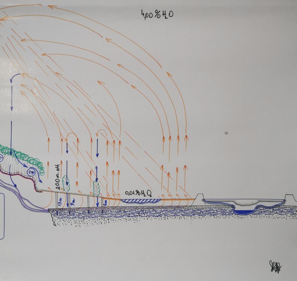
11. Why the groundwater table water level is the same even if since more than 2 years is drought ? If the water level of the mixture of sand, rocks decrease than above is more space in the sand, rocks mixture without water where more air circulate, more condensation is to provide water for the groundwater table ; when the level of groundwater grew is less place for air to circulate, less condensation, less water ; is like a self natural managing of the level of the groundwater table ; this is the reason because of which the water of underground table is from condensation and not from the soil full with all kind of bacteria which are harmful for people health. This is the reason for which the water of groundwater table is never muddy; only during the floods is muddy from the waters which reach in the groundwater table through fountains, soil because of blue clay missing, because the blue clay has no time to be formed during in the short time of floods with water from rainfalls, snow melting, creeks, rivers.
5. By where is the water of glaciers ?
By glaciers melting, as I have found published information, but not only. If would be measured the volume of water which result from the water flow this would be more much than the volume of the ice which is melted. Again because the air from soil, rocks, limestone layer of under glacier is cold; the cold air flow out too because is cold and heavy; the place is taken by warm air which make condensation and water from condensation flow out where the cold air flow out from soil under the glacier. Another source of condensation is the contact between warm air from atmosphere and the surface of glacier appearing again the condensation.
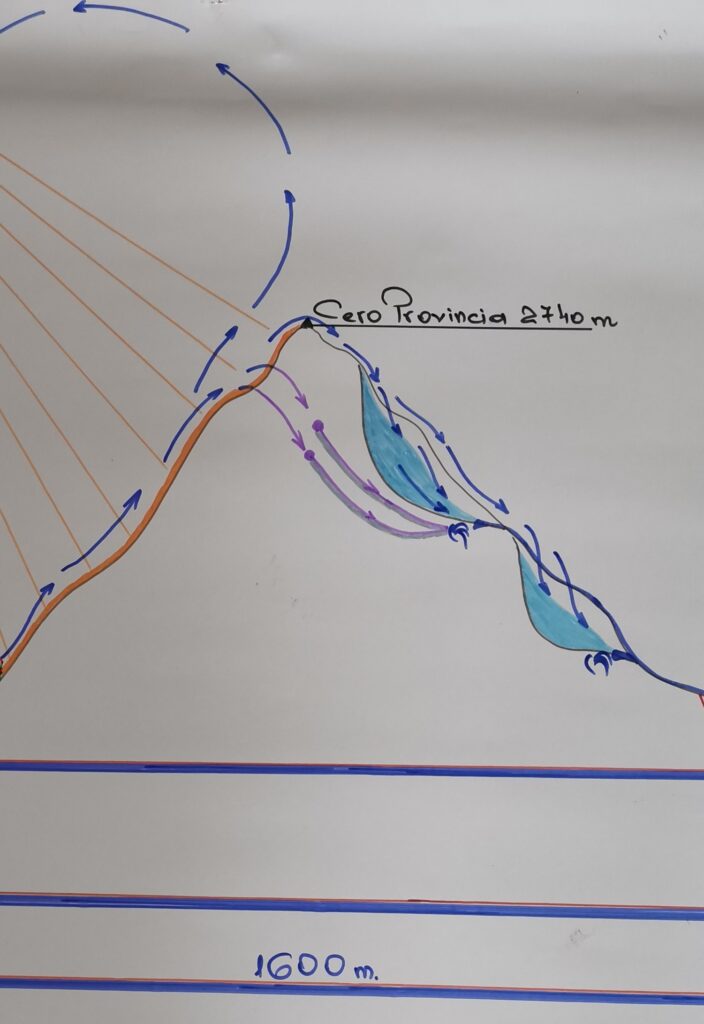
In conclusion : the water of glaciers is not only from glaciers melting as is known, is by underground condensation, under the glacier ; and from the condensation made by the air of atmosphere when touch the surface of glacier.
6. How do we increase the water sources using, stimulating the condensation ?
1. From the published information, considering the drawing of below I have found out that the only animal, mammalian which increase the level of creeks,rivers water flow is the beaver; I have not found information about how; I consider that the little lakes build by beavers have a bigger surface of water than a creek; bigger surface of cold water offer more surface for contact of the warm air from atmosphere which climbed high on the ridge and flow down on the bottom of the valleys with creeks, rivers, little lakes made by beavers, or people; so more condensation resulting more water for lake, creek.
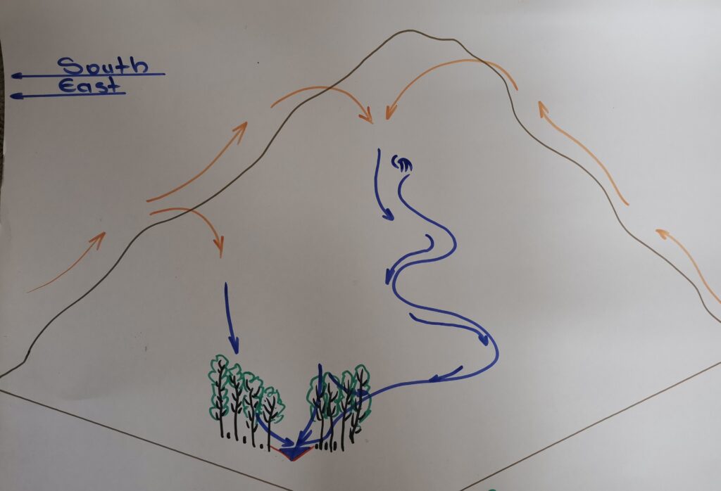
2. We can do the same using mechanized, efficient means to build such little lakes on the level curve which is close to any spring, creek, river.
3. First we prepare the terrain considering the drawing of bellow using certain special machinery having special improvements made for bulldozers, stone separator, compactor, seeders which sow seeds of certain plants which grow in land without permaculture.
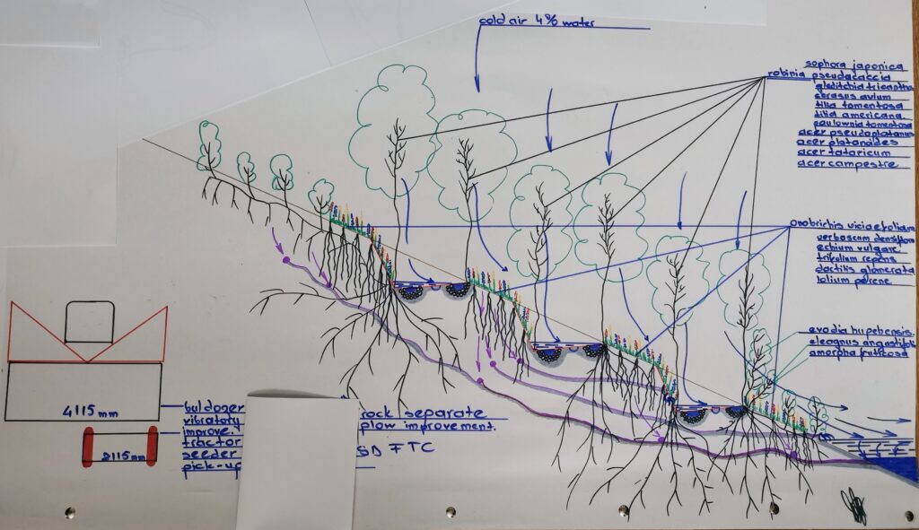
This kind of terrain preparing should respect level curve considering the following distribution :
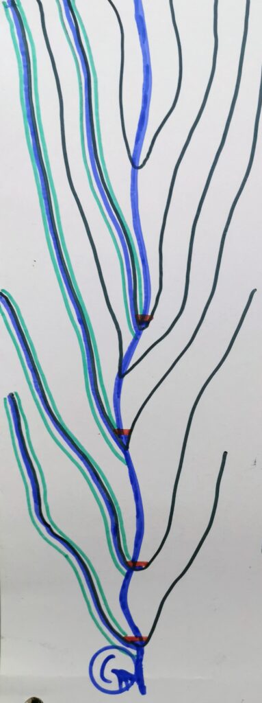
4. On internet I have seen people making compost for the obtaining of permaculture ; is not efficient, is much work, the obtaining of permaculture is more efficient cultivating certain species of plants which grow in land with rocks, sand, eroded without permaculture.
5. The plants found by me which grow in land without permaculture, land with sand, rocks are the following : onobrichis viciaefolia ( montana ), lotus corniculatus, verbascum densiflorum, echium vulgare, trifolium repens, dactilis glomerata, lolium perene, poa pratensis
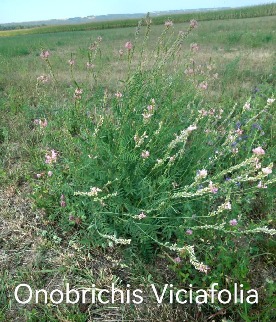
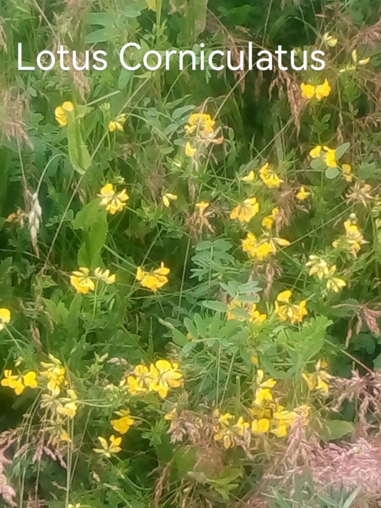
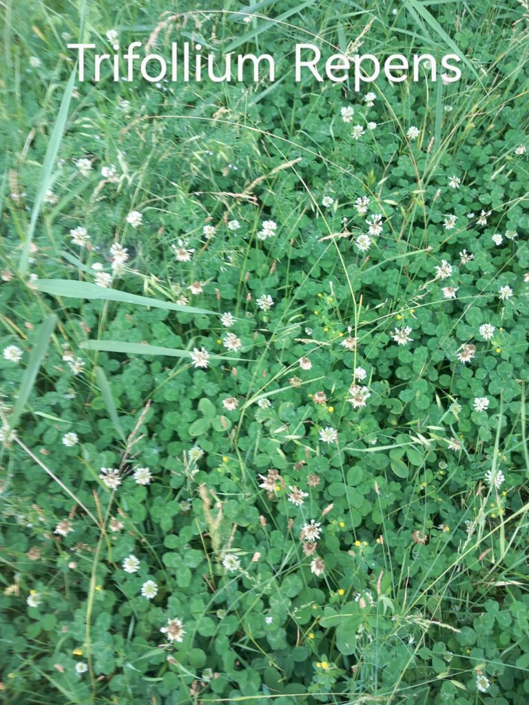
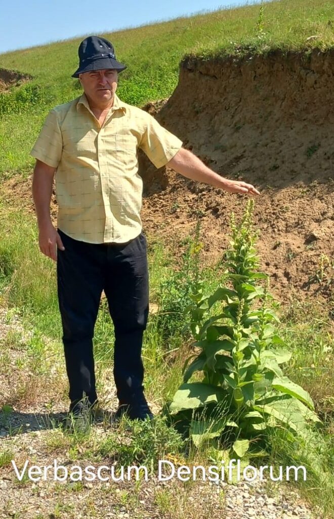
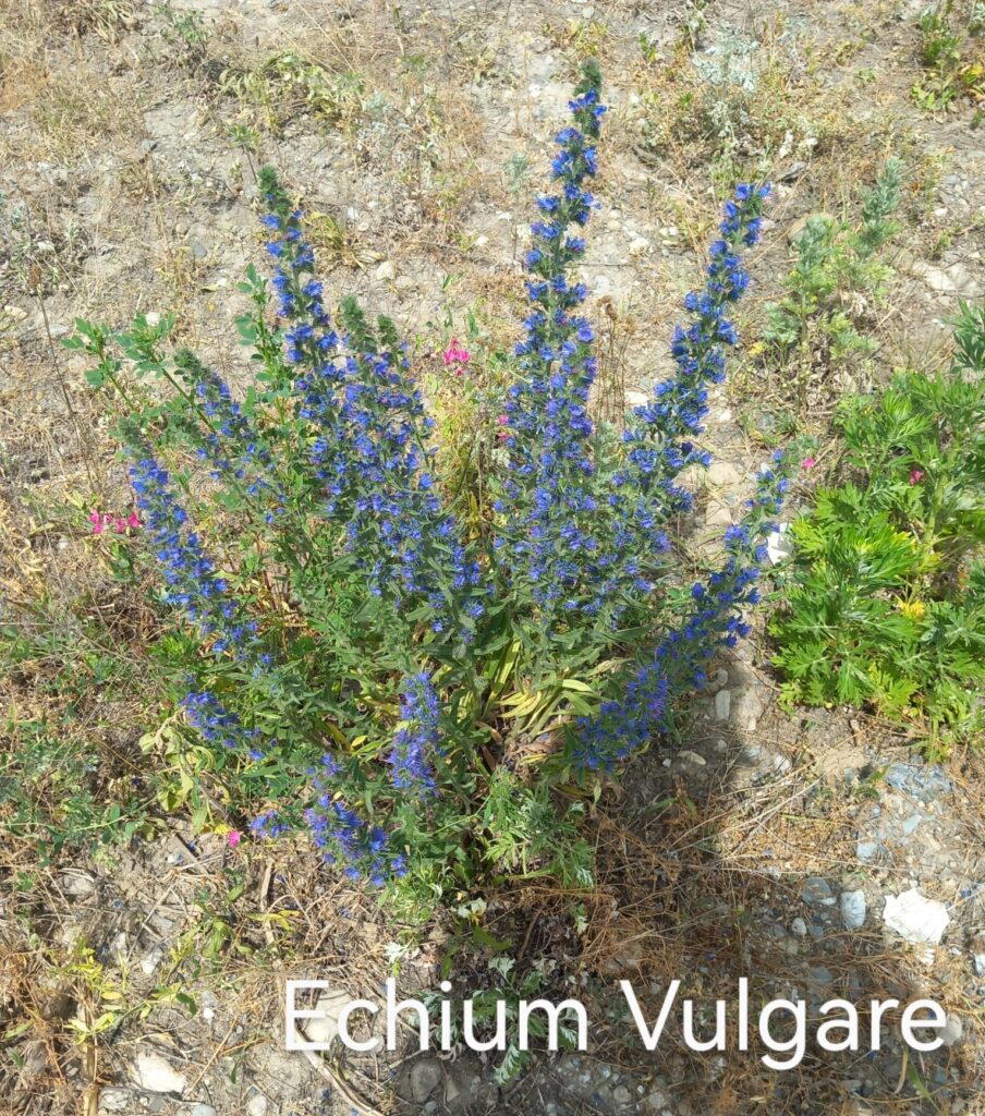
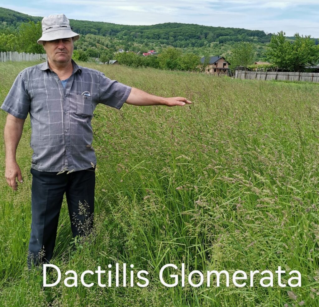
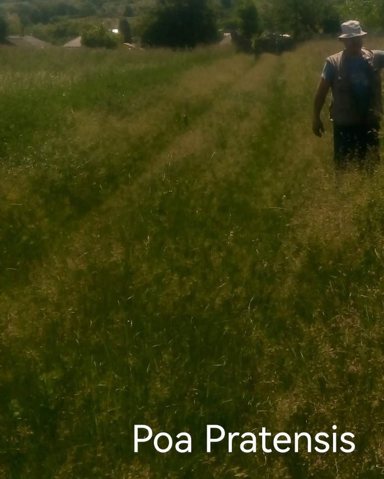
6. The most valuable plants are onobrichis viciaefolia, lotus corniculatus, trifolium repens; because bring nitrogen in soil, resist at drought, are rich in proteins very necessary for livestock feeding, onobrichis viciaefolia having long roots of two meters which help to avoid the land slide in slops; the roots which remain in soil after a such culture are the equal of more than 30 tons of manure which is the perfect start for permaculture making.
7. If these 3 plants mentioned above are planted in monoculture, will not last much time ; therefore is necessary to be sowed in mix with : verbascum densiflorum, echium vulgare, poa pratensis, dactilis glomerata, lolium perene which should use the nitrogen acumulated in soil
8. Using these plants we can cover the soil to protect certain bacteria by the heat of the sun ; this should be the first step to cover the soil to stimulate the condensation under leaves.
9. The next step is to graze these plants only by cows, horses,or other animals which have big size, not grazing the grass too short, resulting especially after cows spots with larger manure around which on a range of 1 meter cows will not graze the grass 1 year, especially trifolium repens, poa pratense, dactilis glomerata, lolium perene having time to bloom and make seeds after a saturated pollination made by bees; the onobrichis viciaefolia propagation is not possible without a saturated pollination made by bees and a certain population of seed eaters birds : passser domesticus, sturnus vulgaris, curruca capirotada, etc. which eating seeds which germination is not affected by the acid of their stomach; spreading the seeds with their manure at long distance. So we can explain how in certain areas occur, grow certain plants which are not growing nearby.


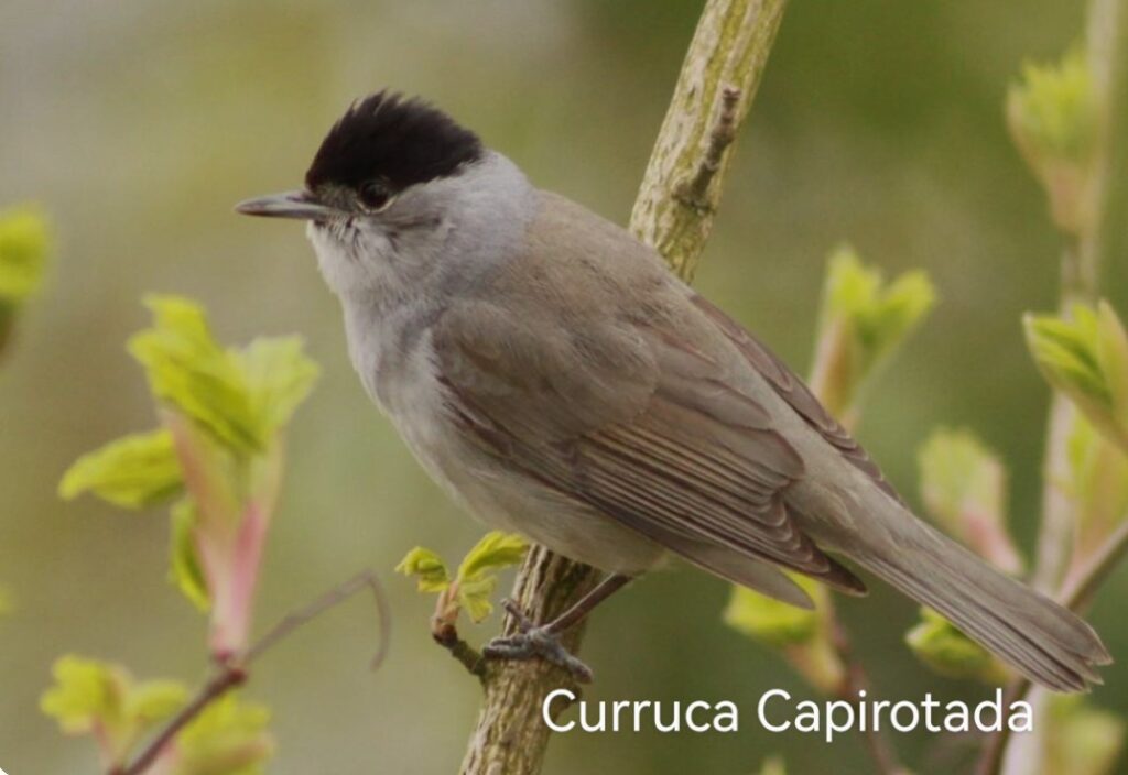
10. At the edges of these little lakes on the level curve should be planted seedlings of : robinia pseudacaccia, gleditchia tricanthos, sophora japonica; trees with dappled shade which bring too nitrogen in soil which is necessary for : picea abies on acid soils, pseudotsuga menziesii glauca on alkaline soils, tillia americana, tillia tomentosa, tillia cordata, cerasus avium, paulownia tomentosa, acer pseudoplatanoides, acer platanoides, acer campestre, evodia hupehensis, eleagnus angustifolia, amorpha fruticosa which provide the dark shade necessary to make downward currents of air which bring down air with more vaporized water ( 4% ) which making contact with the cold surface of the little lake will make condensation increasing the level of water, water flow; from all these species of trees robinia pseudacaccia is the best; is fast growing : 1,2 meters / year offering nitrogen for soil, plants, dappled shade, long roots of 20 meters which make it very adaptable in the most harsh living conditions, different altitudes; in the Middle East was planted and grow at the altitude of 1500 meters in deserted climate on soil without permaculture, picea abies, pseudotsuga menziesii glauca offer cold, dark shade all the time of the year making cold places on the northern, western slops making the possibility to appear springs where two ravines are meeting in one. Another good shade, humidity provider is tillia americana : is fast growing too, in Minnesota State a such seedling reaching to grow 1 meter / year ; growing in average 40 meters tall.
11. This is the method to bring down 4% humidity, chill on the land of desert reducing the atmosphere temperature with 15 C°
12. Considering the global warming effects these 4% vaporized water will be more and more in future increasing the greenhouse effect.
13. Another method to increase the underground currents of air to obtain underground condensation is to plant such forest curtains on the northern, western – southern, eastern slops considering the following distribution.
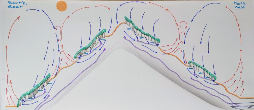
14. The best efficiency of such forest curtains is if the forest curtain is wide as tall are the trees which make the forest curtain.
15. Between these forest curtains should be a certain distance with grass grazed short by sheep, goats, animals of small size to maintain the grass short to be easy warmed by the heat of the sun
7. Why July, August, September are warmer than June, May, April ?
- Considering that the summer solstice is around the date of 20 June, which after the day is shorter, even if the length of the day is the same July, August, September are warmer; why ? because of human impact
2. How is this ?For example : the surface of Romania is of 24.000.000 ha, from which 10.000.000 are plowing, 6.000.000 are cultivated with rape, wheat, barley, oat which are harvested in June , so a quarter of the country surface remain without vegetation, uncovered and so reflect in atmosphere the heat of the sun same as a desert warming the air of atmosphere, which is not happening in June, May, April considering the following drawing.
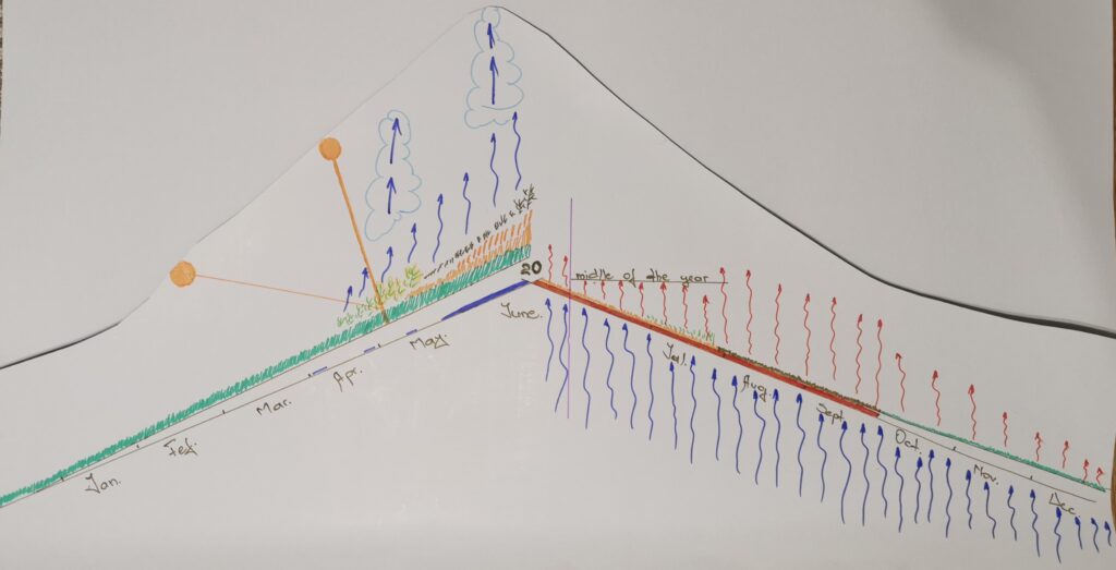
3. from this we can develop a method to increase air circulation in underground, in great plains for example in Texas, Middle East, Southern Plains of South America, etc. how ? Planting trees, cultivate certain plants in a certain distribution considering the drawings of below.
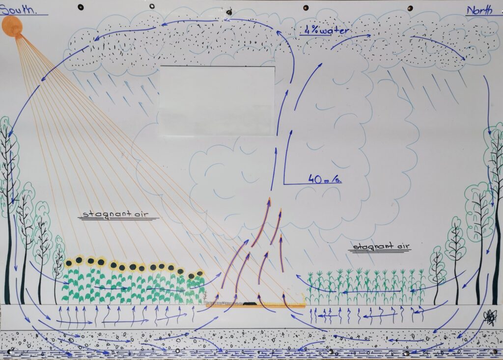
Making stagnant air areas this distribution should be made in the shape of a circle which has at the edge curtain of forest which make downdrafts of air and in the middle cultures of rape, wheat, barley, oat which harvested make a warm spot which increase the air altitude speed which should increase the forming of cumulonimbus clouds in the middle of which is a speed of air of 40 m/s ; the warm air from the warm land surface reaching up, taking fast contact with the cold air could be very possible to occur rainfalls, in the same time is stimulated the enter of the air in soil, water table making condensation and keeping humidity in soil at the level of plant roots. Such circles should have the following distribution:

8. How do we increase water flow, level of creeks, rivers, lakes ?
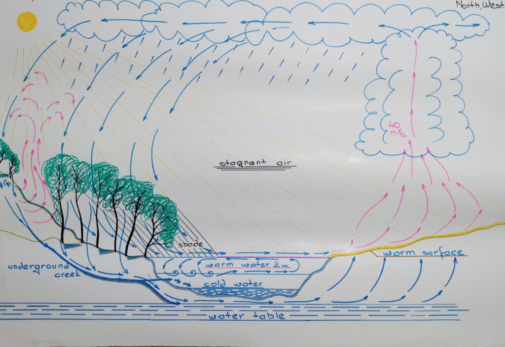
1. When I was young and the lake water was not so polluted like now swimming I noticed that above at the surface of lake water afternoon the water was warm, but under two meters was cold like ice because not existing of vertical water currents. When on Pecos River was about to build the second water reservoir some people was thinking that too much water will be vaporized by the heat of sun, desert.
2. Making too such stagnant air areas we can favorize the forming of cumulonimbus clouds to obtain rainfalls; in the same time planting forest curtain on the eastern and southern side of such reservoirs, lakes, creeks, rivers we can make vertical currents of water to bring up from bottom of water the cold water to cool the water surface for avoiding water vaporization considering the next drawing :
9. How do we stop glaciers melting ?
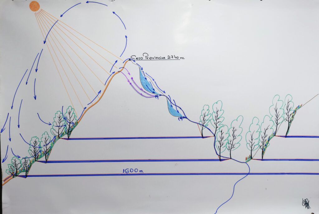
- Considering the effects of the global warming the soil in the northern slopes of Chile are more and more warmer from the heat of the sun making warm currents of air which climb up in the northern slopes and reach down on the surface of the glaciers which because of too much such warm air, currents are melting, shrinking each day a bit and so having a lower surface: lower condensation will be under glaciers underground, on the glaciers surface.
- How we stop this ? Planting curtains of trees at certain altitudes to stop the climbing of the warm air on northern slops; in the same time obtaining the possibility to occur underground creeks for springs in cold places and water for underground water tables considering the following drawing
10. How we can store the water to avoid to reaching in sea, ocean ?
- I noticed that many times the tributaries like Gallinas Creek which flow in Pecos River offer terrain for a bigger reservoir, lake than Santa Rosa Lake, Sumner Lake etc.
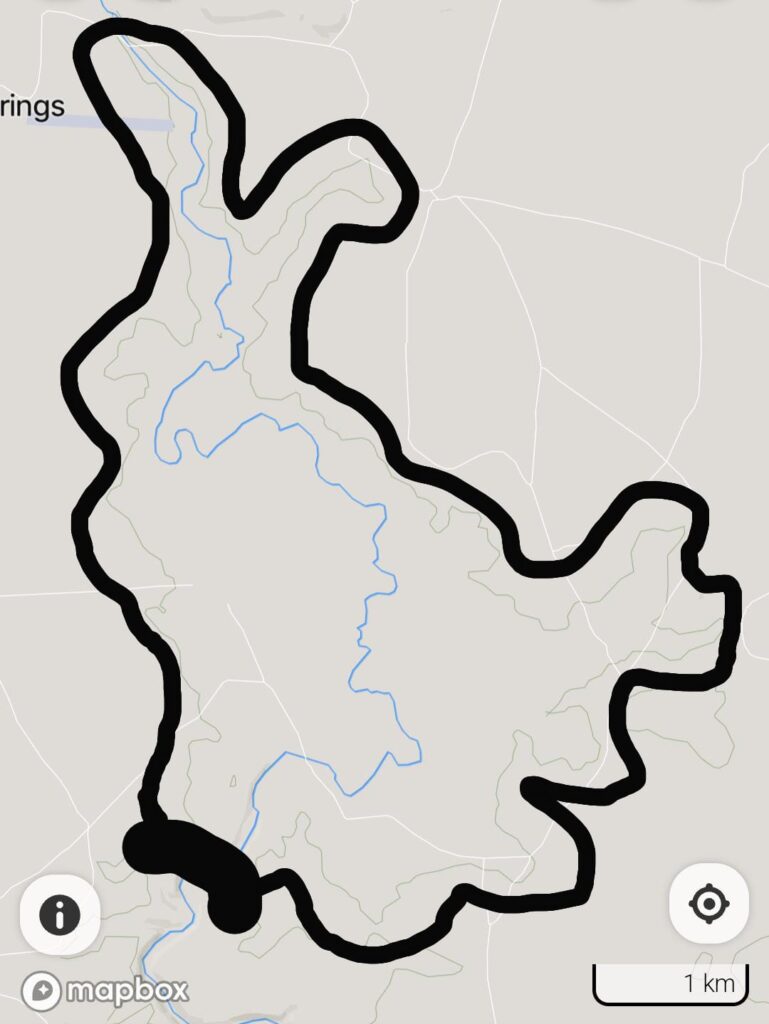
- . How we build the infrastructure for a such lake ? Digging, continuing 30 kilometers the ditch, canal which end in Dilia at the altitude of 1585 meters until a dam build on Gallinas Creek under the level of 1550 meters considering the following map photos :
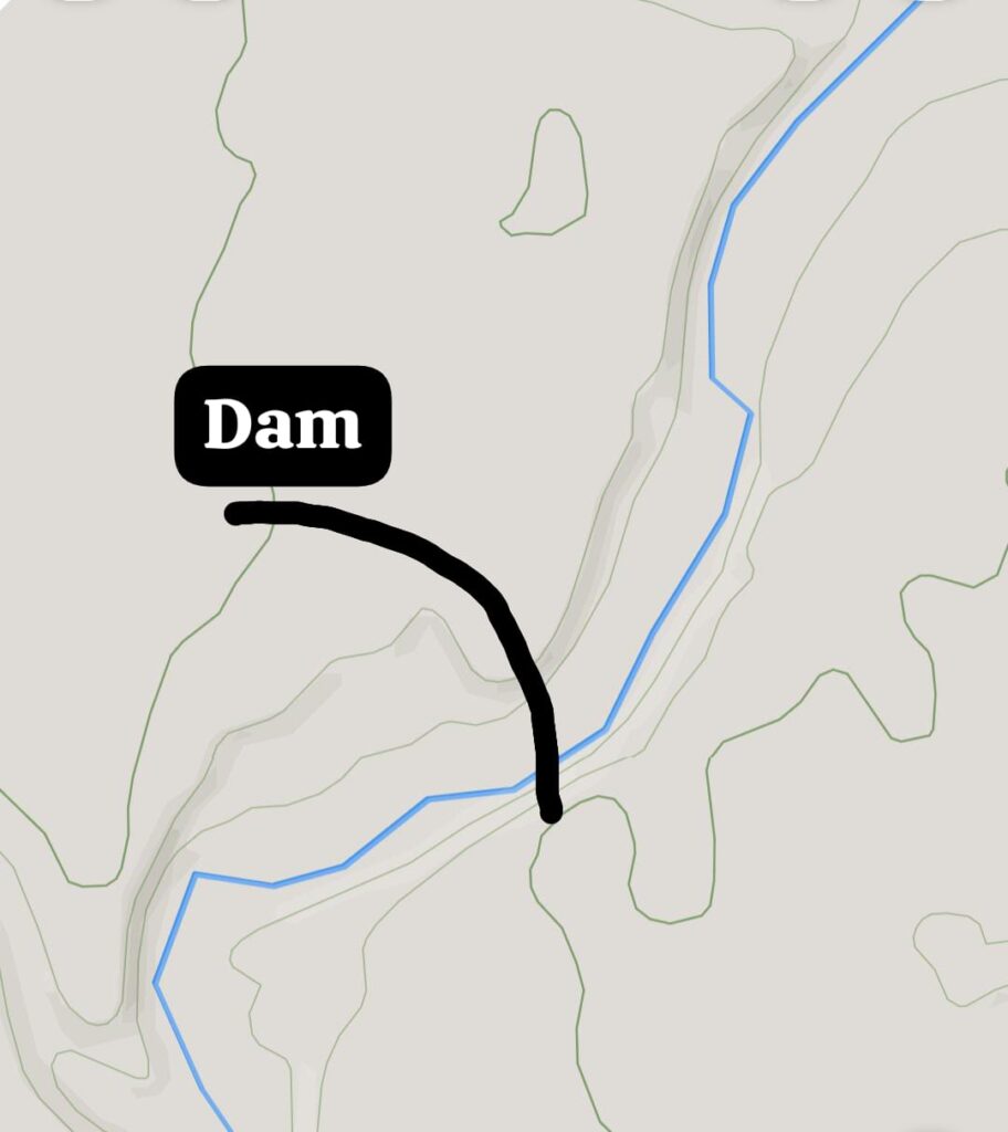
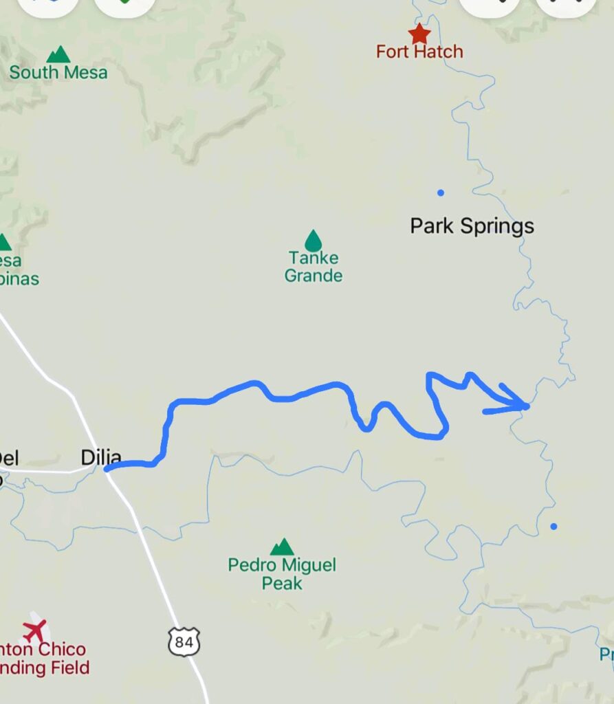
Resulting the following reservoir, lake :
11. How do we stop The Dead Sea drying ?
1. By using too the curve level to bring water from Mediterranean Sea building a pipe from Haifa Port – Afula – Kibbutz Geva ; at Haifa will be necessary a water pump which will push up the water close to Carmel Tunnels – Rav Aluf Yaakov Dori intersection until the level of 130 meters to start the water flow until the end of the pipe at Kibbutz Geva ; after the water will reach at the end of the pipe will flow free without be pumped on a distance of 57 kilometers on the Valley of Nahal Kishon, Nahal Gilboa, Nahal Harod.
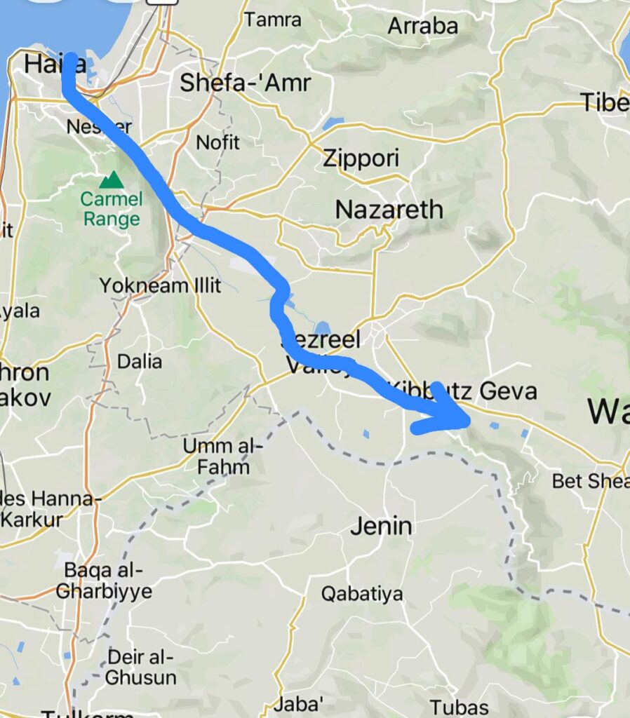
2. Building this pipe and using my solutions to increase the water flow of springs, creeks, rivers, lakes in the basin of Jordan River tributary we can stop the drying of the Dead Sea.
3. Why is necessary a such solution ?
4. Because if the Dead Sea will dry the salt of the sea bottom will be scattered by wind on long distances making the land impossible to be used as farmland, grassland, forest knowing that nothing grow in salt land ; like in the salt desert of south of Spain ; considering the high level of the salt from the Dead Sea, causing a ecological, human disaster, drinking water scarcity, hunger, diseases caused by water scarcity like cholera which already infected, killed thousands of people in Middle East : Lebanon, Syria. Because of cholera a man can lose 25 kilograms in one day, which I consider is terrible and avoidable using my solutions.
5. I have made many such feasibility studies to increase water sources, to restore the environment, to defeat the desert; making it green in many areas of : Chile, Middle East, USA; countries which will be first, most affected by the results of drinking water scarcity mentioned above.
12. How we stop soil erosion making springs in the same time ?
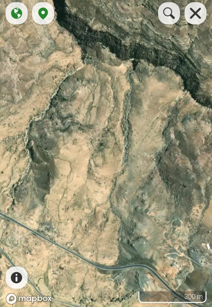
- Not always deserted lands was eroded by wind and water like now. Once long time ago were grasslands, forests; because of human impact, needs, forests were cut down to make place for more grasslands, farmlands. The grasslands were too much grazed by too much times by too many cattle, sheep, livestock, the land reaching warmed too much by the sun heat reaching warm dust, having lower weight was scattered by wind, rainfalls water which made ravines more and more deep like in the following image made by satellite.
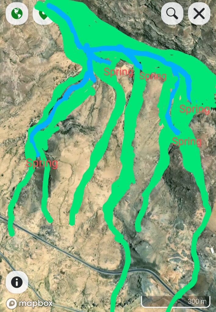
2. If these ravines on a width of 30 meters will be planted with robinia pseudacaccia which has long roots of 20 meters the soil erosion will be stopped , and will provide nitrogen for picea abies, tilia americana, cerasus avium, acer platanoides, acer pseudoplatanoides, which trees will provide cold currents of air in ravines where the cold air of 5 C° of underground will flow out occurring cold spots where two ravines are united in one. In such cold places will occur springs with spring infrastructure through which cold air from underground will flow out from underground, the place of underground spring infrastructure cold air will be taken of warm air from atmosphere which entering in underground will make condensation, a volume decrease of air working like a air pump, resulting condensation and water which trough the spring infrastructure, spring will flow out, considering the following image :
13. How do we evacuate the smog from cities ?
- Is known that the smog is more heavy than the air of atmosphere at a certain temperature but if on the northern, eastern side of cities we will plant trees : robinia pseudacaccia, gleditchia trichantos, sophora japonica to provide nitrogen in soil for the fast growing of picea abies, tilia americana, cerasus avium, acer platanoides, acer pseudoplatanoides, which will make shade, bringing down cold air from the higher altitudes of atmosphere, washing out the smog from cities, in the southern, western side of cities the land if will be without trees, shade the land will be warmer, warming the mixture of smog, cold air to be scattered in atmosphere considering the following draw.
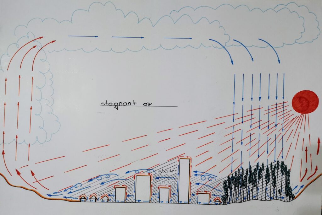
2. In the same time above of cities because of smog result stagnant air which in the days without wind because of the air currents made by this distribution of forest curtains, land without forest , shade will produce cumulonimbus clouds in which the warm air climbing above having a speed of 40 m/s, reaching fast above where the air is cold is made condensation on cold dust from this cold atmosphere making very possible rainfalls occurring.
3. In a certain city with smog forests were planted like walls all around resulting more smog at higher altitude because the trees stopped the forming of such currents of air.
4. The solution is to cut down the trees from the southern, western side of the city, if the city is in a valley of a river, creek should be cut down the trees from downstream of the river no matter of which direction it is the river downstream.
THE PURPOSE OF THIS WORK
In conclusion the water of springs, underground water tables is the result of underground condensation, underground currents of air resulted by thermodynamic phenomena, soil capillarity
These studies are a part of the development of a sum of solutions to restore the environment using mechanized, efficient, with low cost solutions in 7-10 years, why so much time ? Because to achieve this goal we need of trees with fast growing, a certain population of bees, seed eater birds, sparrows: the dead sea sparrow in Hashemite Kingdom of Jordan, the red spotted neck sparrow in Chile, the common sparrow of North America, etc. The next information about I will provide in the next chapters which I do not know how many will be because my method can not be applied without certain species of plants, trees, bees, birds, because without trees, bees, birds the land is deserted place made by : sheep, goats, people, from the very first civilizations ( developed having water sources ) which migrated from Sahara to the Valley of Nile; the Clovis Civilization of southern areas of USA who had no knowledge, respect, consideration for the balance in which Earth should exist.
Some people consider that we are too many on Earth, that until 2050 we should remain only 2 billions ; I don t know who is willing to die ; that wars, pandemics, any means are necessary for this purpose ; I consider my solutions are more human ; if all the deserts will be transformed in farmlands, grasslands, forests using my mechanized , efficient methods then will be more resources to live : water, food, oxygen for more people than we are now.
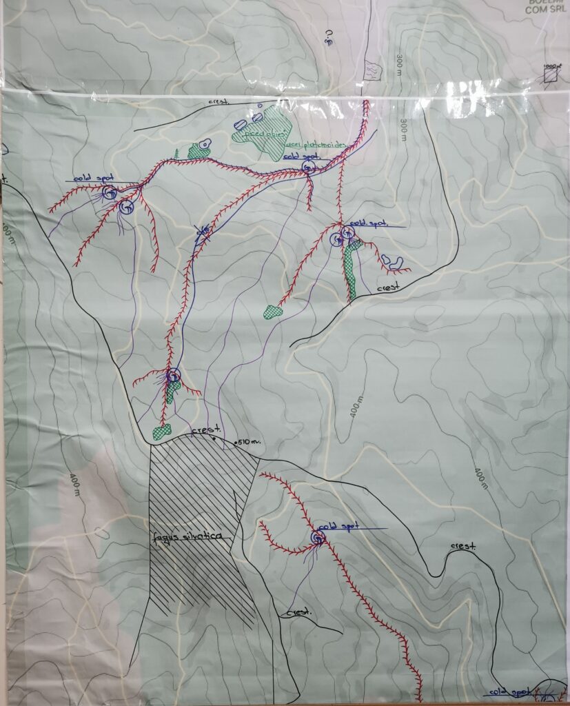
Next : the forest map in which I have made my studies.


Leave a Reply